Latest news from the Himalaya and Karakoram

Tuesday 25 May 2010

Trip Report for Upper Dolpo to Jomsom trek in May 2010

Photo: Bon Po Gompa overlooking Phoksumdo Lake

Our May 2010 Dolpo recce group arrived back to Kathmandu last week after a superb trek. The Upper Dolpo to Jomsom itinerary visits a remote region of Nepal, instead of following the more popular Dolpo Circuit we headed further north to an area very close to the Tibet border and then walked out on the challenging trail to Jomsom thereby completing one section of The Great Himalaya Trail (“GHT”).

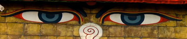
Upper Dolpo is a culturally Tibetan region in West Nepal and during the course of the trek we visited many Buddhist and Bon Po (shamanistic pre Buddhist) monasteries. Up until 1996 foreigners were not allowed access to this region so the culture has largely been unchanged and unaffected by tourism. Of particular interest is Shey Gompa, this is revered as one of most important in Upper Dolpo where twice a year many pilgrims make a kora (or circuit) of Crystal Mountain this is known as a younger brother of Mount Kailash in Tibet.

Upper Dolpo to Jomsom trek is arguably one of the best treks in Nepal” and “better than Lunana Snowman trek in Bhutan!” These were several comments heard while our group discussed the trek on our return Kathmandu last week (and between them this group had done a lot of trekking in the Himalaya).

If this is one of the best treks in the Himalaya then it is worth asking the question, why did we see so few people on the trail? We only met a handful of trekkers during our 3 weeks trip. It is likely that others have been deterred by lack of maps and guidebooks as well as logistical challenges and of course the extra cost to obtain the Restricted Area Permit.

While in Kathmandu I got all of the maps for Upper Dolpo however found they were all out of date and inaccurate. There are no current itineraries with reliable trail descriptions available and even the basic description in the new edition of Lonely Planet “Trekking in Nepal Himalaya” describes the old, disused trail for several sections. During our recce trek we figured out the itinerary from daily discussions with our trek crew, therefore it is essential that the Sirdar and/or cook has visited this region on a previous occasion.

Organising the logistics for this trek are challenging, the Upper Dolpo region is very remote so all groups have to be self reliant in terms of provisions, medical supplies and communications, we used a Thuraya satellite phone that worked well throughout. All food should be brought in with the trekking group as it is not possible to purchase locally in the villages. Our porters and kitchen staff walked in with our supplies for 9 days from the road head near Surkhet to Juphal.

There is no doubt that the difficulties and challenges of trekking in Upper Dolpo are more than worth the effort. We enjoyed seeing a wide variety of landscapes from pine forests in the Suli Gad valley to the stunningly intense blue colour of Phoksumdo Lake. As the trail travels further north the climate becomes dryer as a result of the great Himalayan rain shadow effect. Upper Dolpo is mainly comprised of a high, arid plateau cut by deep gorges in a variety of colours of ochre, sable and tan covered with sporadic vegetation.

Our group saw a lot of wildlife during our trek in Upper Dolpo: many herds of blue sheep, marmots, eagles, lammergeyer, langur monkeys and large variety of birds. We were very close to seeing the ever elusive snow leopard...we passed a trek group coming the other way in a very remote valley in Upper Dolpo who had seen one an hour earlier (this was the only group we saw for 2 weeks), although of course no sight when we got there! We also met a yak herder who had one of his baby yaks snatched by a snow leopard. It is great to know that Snow Leopards are still around, one day, one day...

In terms of time of year my view is that the best time to do this trek is during the month of May, this gives one the best chance of crossing the high passes out to Jomsom. September is probably more popular with trekking groups however often the passes are icey making travel impossible for the pack animals. This year we started the trek from Juphal on April 28th and finished in Jomsom on May 19th. We experienced dry conditions over all passes apart from a few residual winter snow patches on Kang La to Shey however our mules still managed to cross this pass with their loads.

The Mountain Company is planning on organising another Upper Dolpo to Jomsom trek in May 2011, this group will be led by Gary Pfisterer for further information please see our website please get in touch with us soon if you are interested in joining the group.

Roland Hunter
www.themountaincompany.co.uk

Monday 24 May 2010

Upper Dolpo to Jomsom photos: Part One

Photo: STOL airstrip at Juphal
Photo: Ringmo village
Photo: Ringmo Gompa (Bon Po)
Photo: Phoksumdo Lake
Photo: "Daredevil's trail" around Phoksumdo Lake
Photo: Walking to Chunemba
Photo: Looking down valley to Lar Tsa Camp
Photo: Trail to Snowfields
Photo: View from Kang La
Photo: Mules crossing Kang La
Photo: Village boys
Photo: Shey Gompa and Crystal Mountain
Photo: Descending Saldang La
Photo: Mani wall
Photo: Walking to Chharka La

The Mountain Company is organising our Upper Dolpo to Jomsom trek in May 2011, please take a look here for further information.

Roland Hunter
www.themountaincompany.co.uk

Upper Dolpo to Jomsom photos: Part Two

Photo: Namgung gompa
Photo: below Karang village
Photo: Tora Sumna Camp
Photo: near Yangur village
Photo: gorge after Yangur village
Photo: View from Muri La
Photo: Ladies from Tinje village
Photo: ploughing with Yaks
Photo: Lady from Tinje village
Photo: House from Tinje village
Photo: approaching Charka La
Photo: Mount Dhaulagiri from Charka La
Photo: girls from Charka village
Photo: Dagarjun village with Tilicho Peak behind

The Mountain Company is organising our Upper Dolpo to Jomsom trek in May 2011, please take a look here for further information

Roland Hunter
www.themountaincompany.co.uk

Friday 23 April 2010

Summits of Island Peak!

Photo: climbing to summit of Island Peak

Well done to our Island Peak expedition: Sophie, Garnet and Jo all summited Island Peak on April 18th. Thanks to their climbing Sherpa, Nurbu, who led this trip. The Mountain Company has now organised successful expeditions to Island Peak every Spring for the last four years.
If you are interested in joining one of our expeditions please get in touch with us

Roland Hunter
www.themountaincompany.co.uk

Wednesday 14 April 2010

Trekking from Helambu into Langtang via Laurebina La pass and Gosainkund

Namaste and Happy New (Nepali) Year! It is now year 2067 in Nepal, there were big celebrations last night in Kathmandu. I just got back after a trek from Sundarijal on the outskirts of Kathmandu through Helambu over Laurebina La passing Gosainkund lakes and into the Langtang valley. Early April is a good time of year to do this trek as the rhododendrons are in full bloom with white, pink and red flowers covering the hills. Now I understand why laliguras (Nepalese for rhododendron) is their national flower!
The drawback of trekking in the middle hills of Nepal during this time of year is a the presence of a thick haze that obscures the views however once over 4,000m one rises above this and the mountain views from Laurebina La were superb (see photo). Certainly the views would be clearer during the period October to January although of course the rhododendrons would not be in flower at that time, as ever there are pros and cons of trekking for each month in Nepal.

Photo: terraced field in Helambu

We approached this trek in a reverse direction to most itineraries including The Mountain Company's Langtang and Laurebina La trek i.e most people start from Langtang then head over Laurebina La into Helambu and walk back to Kathmandu whereas this time we walked the other way from Kathmandu into Langtang. In fact I think both directions work well for this trek, of course either way it is important to be sufficiently acclimatised before crossing Laurebina La at 4,700m.
Our Kathmandu to Langtang itinerary seemed to work well as everyone felt strong going over Laurebina La and no-one had any headaches throughout the trek. I was conservative with the time acclimatising before the pass by spending one night at Magin Goth (3,200m), next at Tharepati (3,500m) followed by Phedi (3,700m) and then next day crossing Laurebina La.

Photo: rhododendrons in flower

On leaving Magin Goth on the trail to Tharepati we met a Sherpa family walking back to Kathmandu after having spent their easter holidays with relatives at Kutumsang village. We walked together chatting about how life differs living in Kathmandu compared to the village. On the way the father of the family pointed an interesting shaped rock and explained how this was formed when Guru Rinpoche kneeled on this spot and meditated. At this point they asked if I would like to join in their puja ceremony, the father chanted mantras and gave everyone some rice to throw over the rock. It was a lovely experience and without meeting this family we would have wandered past without knowing how important this particular rock is!

Photo: Guru Rinpoche's rock

In December 1991 James Scott a 22 year old Australian medical student attempted to cross Laurebina La however subsequently become lost for 43 days with only a couple of chocolate bars for sustenance. At this time of year sudden winter storms can happen at this altitude, and this is what happened as James approached the pass and at the time decided to turn back by himself. He followed the drainage hoping to get to Talu village however soon was unable to proceed due to a steep waterfall and after a while found shelter under a narrow rock ledge. 
Another event occurred in this area on July 1992 when Thai International flight 311 crashed close to Phedi below Laurebina La sadly killing all 113 people on board. There is now a chorten next to the teahouse lodge at Phedi in remembrance of a Japanese passenger who was on this flight.
Our day crossing Laurebina La and walking past Gosainkund lakes was definitely the highlight of this trek, luckily the weather was good and at that altitude we were above the haze as mentioned earlier in this article. The Gosainkund lakes are a pilgrimmage site for Hindus during the summer months. The lakes are said to have been formed by the digging of Lord Shivas' holy three pointed sword known as a Trishul after he drank the poison from Samudramanthan in order to get some cold water to quench the heat of the burning poison. The Gosainkund lakes are the source of the Trishuli river that flows through Nepal.

Photo: Gosainkund lake and teahouse lodges
Photo: old chorten above Bharku village
Once we trekked past the Gosainkund lakes we walked into the Langtang valley, the villages here are inhabited by Tamangs whereas on the Helambu side the higher villages such as Kutumsang are Sherpa. Tamangs came from Tibet about 500 years ago and still follow Tibetan Buddhism. The villages in this area are well known for the intricately carved wooden window frames.
Photo: carved windows at Bharku village


Please get in touch with us if you are interested in joining this trek or would like any information, take a look at our website for our Langtang and Laurebina La itinerary and Trip Dossier

Roland Hunter
www.themountaincompany.co.uk

Saturday 27 March 2010

Good to be back in Kathmandu!

Photo: Thamel in Kathmandu

As usual it is good to be back in Kathmandu, the weather is sunny and warm so it is looking like a good start to the Spring trekking and mountaineering season. Climbers on Annapurna are taking advantage of these good conditions and are making good progress on the mountain currently fixing ropes between Camp Two and Three.
There have been several changes announced recently over the trekking permits for Nepal (called Trekkers Information Management System or TIMS). There are now two types: firstly organised group trekkers will be issued a blue TIMS card costing US$10 and secondly independent trekkers will be issued a green TIMS card costing US$20. TIMS cards will be checked while on trek so it is important you have these otherwise you might be returned to Kathmandu! The new TIMS rules are effective from April 1st 2010.
I read an interesting article this morning from the New York Times, the piece discusses the Annapurna Circuit and the impact of the new road on this classic trail. At The Mountain Company we have been aware for a long time of this issue, we have been working hard developing our portfolio of treks to visit remote regions to avoid the ever increasing road construction in the hills of Nepal.
If you are looking for a trek with similar landscape and characteristics of the Annapurna Circuit you could consider the Manaslu Circuit to the east of the Annapurna Circuit. This trek starts at Arughat and finishes at Besishar the starting point of the Annapurna Circuit. Or for a more challenging alternative you could trek the Dhaulagiri Circuit that joins the Annapurna Circuit at Marpha however we then fly out from Jomsom so avoiding most of the road.
If you are looking to get away from the roads and busy trails then you should think about walking along the new Great Himalaya Trail ("GHT"), we are organising two sections of GHT firstly Upper Dolpo to Jomsom in April 2010 and Makalu BC to Khumbu in April 2011. Please get in touch with The Mountain Company if you are interested in joining one of these groups.

Roland Hunter
www.themountaincompany.co.uk

Thursday 4 March 2010

Our Upper (Inner) Dolpo to Jomsom trek in April/ May 2010

Photo: Upper (Inner) Dolpo

Is anybody interested in joining an adventurous reconnaisance trek exploring a remote region near the Nepal and Tibet border starting in late April this year? If so, please read on....

As mentioned in our New Year newsletter we are organising a trek to Upper Dolpo in Nepal from April 25th to May 22nd 2010. I am leading this trek along with several of our Sherpa guides.

Upper Dolpo is a remote region in northern Nepal where few other groups have visited, I have no doubt this trek will be a superb journey. The trail crosses a number of high passes as well as exploring unspoilt Tibetan Buddhist villages and monasteries along the way.

Most other trekking companies run the relatively easier Upper Dolpo Circuit whereas we plan to walk out on the remote and challenging trail to Jomsom along a section of The Great Himalaya Trail.

Upper Dolpo has near mythical status among travellers and was first written about by David Snelgrove in his book titled "Himalayan Pilgrimmage" and more recently by Peter Matthiessen in "The Snow Leopard".

Please get in touch soon if you would like to join our group, for more information on the Upper Dolpo to Jomsom trek

Roland Hunter
www.themountaincompany.co.uk

The Mountain Company